Domestic students
$3,020
estimated total program cost

Learn to create maps and work with geographic data
Learn to create maps, work with geographic data and use ArcGIS software. Build foundational skills in cartography, data management, project planning and data collection through 175 hours of practical GIS training.

Microcredential Microcredentials are short, targeted programs that focus on specific skills needed by employers or communities. They are often industry-recognized and can help you enter the workforce quickly or continue your education.
Online (asynchronous) Online (asynchronous)
Online Online
TBD
Domestic students $3,020 estimated total program cost Domestic students Estimated first-year cost Kelowna, Penticton and Salmon Arm: $3,020 Estimated total program cost Kelowna, Penticton and Salmon Arm: $3,020
TBD
Take the first step toward a rewarding career—the GIS Essentials microcredential through InspirED at Okanagan College can take you there! In the 175-hour program, you’ll gain an in-depth understanding of map creation using ArcGIS software and cartography while gaining the hands-on skills that employers value. From private industry to consulting and government, this program opens doors to exciting opportunities.
Our program has evolved - formerly known as the Advanced GIS Certificate, we now offer a suite of stackable microcredentials designed to provide greater flexibility and targeted learning. Start with the GIS Essentials Microcredential, then build your expertise with the Advanced GIS, 3D Modeling and Remote Sensing in GIS, and/or the GIS Database Management microcredentials. Tailor your education to your goals and industry needs!
By the end of the microcredential, you'll be able to:
The microcredential focuses on practical learning through GIS exercises and applied coursework. It does not include a formal work placement.

Shelley Desautels, BA, Adv. Dip. GIS
Desautels has worked in the GIS industry for over 9 years and runs her own mapping and consulting firm. She has a Bachelor of Arts – Geography degree, plus an Advanced GIS Diploma from BCIT. Her favorite part of teaching the GIS Certificate Program is seeing the growth of her students from a basic understanding of GIS to a skill level that is fully ready to enter the work force by the end of the course.
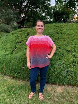
Tammi Mills, B.Sc.
Mills completed her B.Sc. in Archaeology and Geography at the University of Lethbridge in 2009 with a concentration in GIS. She then continued on, earning a Master’s degree in Archaeology where she used the GIS to spatially analyze an archaeological site in southern Alberta. Tammi then went to work in the archaeological consulting field for over 10 years where the preferred mapping software was ESRI’s ArcGIS. Using her skills from university, Tammi was able to assist with large and small-scale mapping projects for clients. During her studies and while working in the consulting community, Tammi was also able to work with First Nation’s and indigenous communities in Northeastern British Columbia, Alberta, Saskatchewan, and Manitoba. After taking a brief hiatus from the archaeological community, Tammi is excited to be continuing her education with a PhD in Remote Sensing at the University of Lethbridge. Her preliminary research will focus on the use of LIDAR, structure from motion and thermal imaging, and will be exploring the utility of these systems in identifying and surveying archaeological sites.

Omar Algiasena, MGISA, BTech (GIS), BSc
Omar holds a Master of Geographic Information Systems Applications from Vancouver Island University and a Bachelor of Technology in GIS from the British Columbia Institute of Technology, along with multiple Esri technical certifications. Omar Algiasena has more than 10 years of experience in GIS, geomatics, surveying, and project management, working across utility, municipal, and energy projects. In addition to teaching in Okanagan College’s GIS Microcredential Programs, he serves as a GIS Consultant with Esri Canada, specializing in enterprise GIS, Utility Network implementation, web and mobile mapping solutions, and GIS workflow automation. Omar holds advanced GIS credentials from Vancouver Island University and BCIT, along with multiple Esri technical certifications. As an Okanagan College graduate himself, he enjoys helping students build practical, job-ready GIS skills and connecting classroom learning to real-world industry applications.
Through a blend of theory and practice, learners in the 175-hour Geographic Information Systems Essentials Microcredential will gain an in-depth understanding of how to create maps using ArcGIS software and the fundamentals of cartography; identify and work with the datasets used in Geographic Information Systems; the basics of project management; and various data collection methods. The essential skills learned in this micro-credential will prepare students for various employment opportunities in private industry, consulting, government, forestry, First Nations and mining sectors.
This microcredential is the pre-requisite to the Advanced Geographic Information Systems, Geographic Information Systems Database Management, and 3D Modeling and Remote Sensing in Geographic Information Systems Microcredentials.
Check if this program is student loan eligible. View Financial Aid and Awards
All amounts are approximate and are subject to change.
This program qualifies for the Future Skills Grant, which can cover up to $3,500 of your tuition costs
Online Asynchronous Learning: This training allows students to access course materials anytime with tutor-supported (no direct instruction)
and
Learners should expect a minimum 10 hours per week for coursework.
Future Skill Grant Eligible - Jan 2027
|
Start/End dates
|
Location
|
Delivery mode
|
Application status
|
|---|---|---|---|
|
Jan. 11, 2027 - May. 16, 2027
|
Distance Education
|
Online (asynchronous)
|
Open
|
|
Note: Part-time. Online Asynchronous and tutor-supported (no direct instruction), with set due dates for assignments/projects.
|
|||
The application period ends when the program is full. It is strongly encouraged to apply as soon as possible to avoid being waitlisted.
Yes, the entirety of the program is delivered online.
Tech requirements can be found here.